Kadamjay District (Kadamjaiskiy Raion)
Kadamjay District (Кадамжай району; Кадамжайский район) is a district in Batken Region, in south-western Kyrgyzstan. The administrative seat lies at Kadamjay. The district area is 6146 km2, and its resident population was 201,457 in 2021. The largest town of the district, Kadamjay, is located between the cities of Aydarken (Khaidarkan) and Kyzyl-Kyya.
The district is thought to have the second largest mercury-antimony deposit in the world. Kadamjay Antimony Factory is one of the biggest factories in Kyrgyzstan. Khaidarkan Mercury Plant, built in 1942, was reported, as of 2005, to produce 300 to 600 metric tons of mercury per year.
Ak-Suu (white river) is the river which passes through Kadamjay. Jiydelik lake is a favorite picnic spot.
Map - Kadamjay District (Kadamjaiskiy Raion)
Map
Country - Kyrgyzstan
 |
 |
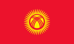
| Flag of Kyrgyzstan | |
Ethnic Kyrgyz make up the majority of the country's 6.6 million people, followed by significant minorities of Uzbeks and Russians. The Kyrgyz language is closely related to other Turkic languages.
Currency / Language
| ISO | Currency | Symbol | Significant figures |
|---|---|---|---|
| KGS | Kyrgyzstani som | Ñ | 2 |
| ISO | Language |
|---|---|
| KY | Kirghiz language |
| RU | Russian language |
| UZ | Uzbek language |


